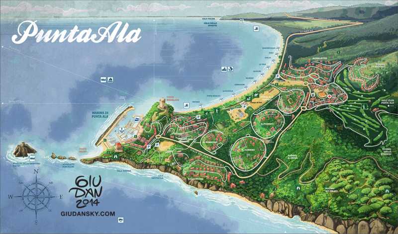
Ecco la mia mappa illustrata di PuntaAla, realizzata per Wire, Innocenti Editore e stampata in grande formato pieghevole. E' ricostruita da foto satellitari, panoramiche e ricordi personali. Disegnata albero per albero, sentiro per sentiero, davvero un gran lavoro.
Non c'è cosa più difficile che illustrare una mappa; Infiniti dettagli, toponimi, vie di comunicazione devono rispecchiare la realtà e coincidere con gli elementi disegnati. Una mappa illustrata tuttavia non deve ricalcare le mappe satellitari: per quello c'è già google maps. Deve invece reinterpretare gli spazi e alterarli in dimensioni e prospettiva in modo che i luoghi diventino caricaturali, esotici, più piacevoli a vedersi.
Per avere la versione stampata di questa mappa, rivolgetevi a Innocenti Editore. Se siete interessati a realizzare una illustrazione potete invece contattarmi direttamente.
Eng:
My illustrated map of PuntaAla, commissioned by Wire Innocenti Editore. It's a huge table, reconstructed from aerial photos, panoramics and personal rememberings. Drew tree by tree, path by path, a really long work,
Nothing it's more difficult than illustrating a map; lots of details and elements, plus all the connected roads and toponims must reflect the reality.
However, a map should not be traced from aerial ortophoto maps: there's google maps for that. It should reinterpret geography and altering spaces and perspective so the places gets a carcicatural and exotic style, more pleasent to read.
Contact me for more informations.


Follow me for updates or contact me on the socials